Drones in environmental conservation efforts can make a difference
Drones in environmental conservation efforts enhance monitoring, data collection, and community engagement, providing vital tools for protecting wildlife and combating deforestation.
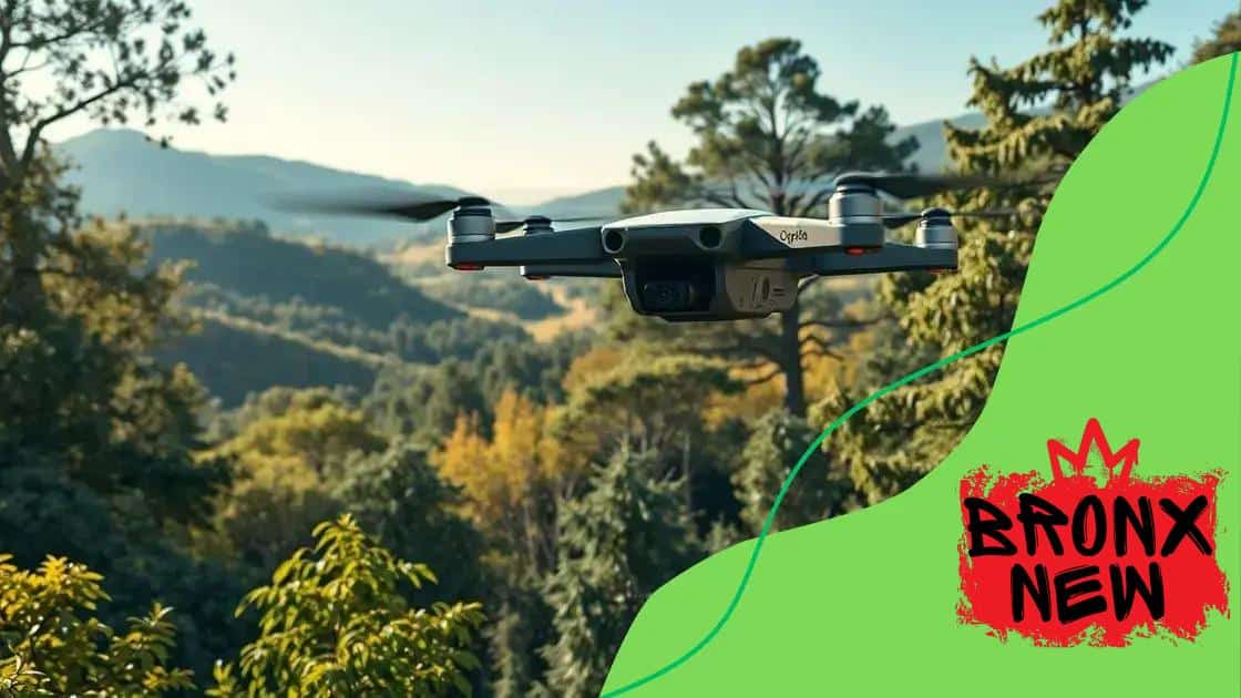
Drones in environmental conservation efforts are revolutionizing how we approach sustainability. Have you ever wondered how aerial views can help us protect endangered species? Let’s explore this innovative technology.
The role of drones in wildlife monitoring
Understanding the role of drones in wildlife monitoring is essential for modern conservation efforts. Drones are changing how we track animal movements and monitor their habitats. They provide a unique aerial perspective, allowing researchers to cover large areas quickly.
Advantages of Using Drones
Drones offer several advantages in wildlife monitoring:
- Cost-effective compared to traditional survey methods.
- Minimizes human disturbance to delicate ecosystems.
- Ability to access remote locations with ease.
With advanced camera technology, drones can capture high-resolution images, helping scientists identify species and track populations. They can follow migration patterns and monitor nesting sites without disturbing the animals.
Data Collection and Analysis
Not only do drones provide visual data, but they also collect valuable information such as temperature and humidity. This data helps researchers understand the environmental conditions affecting wildlife.
Moreover, the information gathered can be analyzed using various software tools. This analysis contributes to developing strategies for protecting endangered species and habitats.
As drone technology evolves, so does the potential for wildlife monitoring. With better sensors and longer flight times, researchers can obtain more comprehensive data. This ongoing innovation ensures that we remain at the forefront of conservation.
How drones help combat deforestation
Drones play a crucial role in helping to combat deforestation. With their advanced technology, they can efficiently monitor and manage forest areas. This is vital as forests provide essential resources and habitats for countless species.
Monitoring and Mapping
One of the key benefits of using drones is their ability to create detailed maps of forest regions. These maps show tree density, health, and species diversity. This information allows conservationists to identify areas most at risk of deforestation.
- Drones can cover large areas quickly and affordably.
- They capture high-resolution images for precise analysis.
- Using GPS technology, drones provide accurate data on forest changes over time.
This capability helps teams make informed decisions on where to focus their conservation efforts. Regular monitoring ensures we can respond swiftly to any threats to our forests.
Data Collection for Conservation
Drones are not just for monitoring; they also help collect critical data. By gathering information on climate conditions, soil quality, and water resources, drones can provide insights into the health of forest ecosystems.
These insights help to develop strategies that mitigate the impacts of deforestation. For example, understanding the factors that lead to tree loss allows for targeted reforestation efforts. With focused initiatives, we can restore areas that have been damaged.
As technology progresses, the tools used in drone operations become more sophisticated. This continuously enhances our ability to track and combat deforestation effectively and sustainably.
Drones for collecting environmental data

Drones are revolutionizing the way we collect environmental data. Their versatility allows researchers to capture vital information about ecosystems without disturbing wildlife. This innovation is crucial for informing conservation efforts.
Types of Data Collected by Drones
Drones can gather various types of environmental data through different sensors. Some examples include:
- Thermal imaging to check temperatures of land and water
- Multispectral images to monitor plant health and vegetation
- Lidar data for mapping topography and forest structures
This rich array of data enables scientists to analyze changes over time. By using drones, they can track the effects of climate change and human activities on natural habitats.
Applications of Environmental Data
The data collected by drones has numerous applications. For example, it helps in managing natural resources and evaluating the health of specific environments. Conservationists utilize this information to plan targeted interventions.
Monitoring water quality and soil conditions is critical for sustainable agriculture and forestry. Drones can quickly provide data that traditional methods may miss. This speed is essential for responding to environmental issues effectively.
As technology advances, the capabilities of drones continue to expand. Improved sensors and data processing techniques allow for more accurate and comprehensive environmental assessments. This evolution is vital for developing effective strategies to protect ecosystems.
Enhancing conservation efforts with drone technology
Enhancing conservation efforts with drone technology has changed the way we protect our environment. Drones provide unique advantages that traditional methods cannot match, allowing for more effective conservation strategies.
Precision in Monitoring
Drones allow for precise monitoring of wildlife populations and their habitats. By offering an aerial view, conservationists can easily identify changes in landscapes and wildlife behaviors. This information is crucial in understanding how to protect endangered species.
- Real-time data collection for quicker responses.
- Ability to cover vast areas with minimal human disturbance.
- High-resolution images that enable detailed analysis.
With the use of drones, conservation teams can deploy resources more efficiently. They can locate areas that need immediate attention and take appropriate action to mitigate threats.
Community Engagement and Awareness
Drone technology also plays a role in engaging local communities in conservation efforts. Sharing aerial footage of wildlife and habitats can inspire people to participate in conservation initiatives. When communities see their natural surroundings from a new perspective, it fosters a deeper connection to the environment.
Educational programs that utilize drone imagery can raise awareness about conservation challenges. Empowering communities with knowledge is an important step in ensuring the success of conservation efforts.
Ultimately, combining modern drone technology with conservation practices creates a more robust framework for protecting our planet’s biodiversity. As technology advances, these efforts will only become more effective and comprehensive.
Future trends of drones in environmental protection
The future trends of drones in environmental protection are full of promise and innovation. As technology continues to advance, the capabilities of drones are expanding, leading to more effective conservation solutions.
Innovative Technologies
New technologies are being integrated into drone systems. For example, drones are now equipped with AI and machine learning. These features allow drones to analyze data in real-time, improving decision-making in conservation efforts. Additionally, advancements in sensor technology enable drones to capture more detailed environmental data.
- Enhanced imaging capabilities for better wildlife monitoring.
- Advanced GPS technology for precise location data.
- Hydrographic sensors for analyzing water bodies.
As these technologies improve, drones will help scientists gather crucial information faster and more accurately.
Increased Accessibility
In the future, drones will become more accessible to researchers, conservationists, and even local communities. Lower costs for drones and clearer regulations will encourage more organizations to utilize this technology. With increased accessibility, more data can be collected to support various environmental protection initiatives.
This shift will empower local communities to monitor their natural areas and engage in conservation practices actively. Community involvement is essential for effective environmental stewardship and protection.
As the role of drones in environmental protection expands, we can expect greater collaboration between technology and conservation. The potential for innovation in this field is significant, promising a brighter future for our planet’s ecosystems.
FAQ – Frequently Asked Questions about Drones in Environmental Conservation
How do drones help monitor wildlife?
Drones provide real-time data on wildlife populations and their habitats, allowing for effective tracking and protection.
What role do drones play in combating deforestation?
Drones help create detailed maps of forested areas, monitoring changes and identifying regions at risk of deforestation.
What types of data can drones collect for environmental studies?
Drones can gather various data, such as thermal images, multispectral images, and environmental conditions like temperature and humidity.
How can communities engage with drone technology?
Drones provide aerial footage that can educate and inspire local communities to participate in conservation initiatives and protect their environments.


